Overall plan
Heads up! Sierre-Zinal route closure and detour from April 28th to June 30th, 2025.
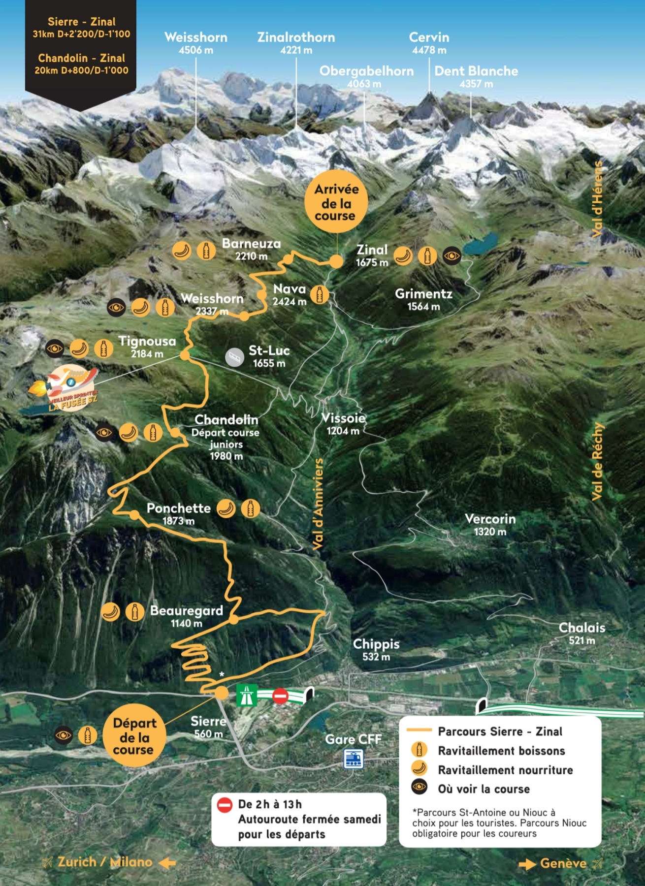
OVERVIEW
The 3D map below provides an overview of the legendary Sierre-Zinal course. From the start in the plain of Sierre to the finish in Zinal, the route covers 31 km, including 11 km between Sierre and Chandolin and 20 km between Chandolin and Zinal, with over 2,000 metres of elevation gain, through forests, alpine pastures and mountain ridges.
You will find:
- The 9 refreshment stations (food & drinks)
- Public access areas to cheer on the runners
- The altitude of the main checkpoints
- Practical information on road closures